

HOMELOFT BASICS
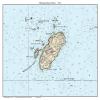
Monhegan Island - 2014 Maine Nautical Map - Harbor Custom Reprint - Chart 13301
RM431.99
RM719.98
-
 Order within to get between
-
 Tracked Shipping on All Orders
-
 14-Day Returns
- Secure Payments
-
 24/7 Customer Support
Description
- Map reprinted on high quality bond paper
This chart of Monhegan Island, Maine is a custom map I made out of the larger map called "Muscongus Bay". It shows topography, water depths, and nautical features, and contour lines. From the archives of the US Coast Survey. We have edited the original image to improve the appearance of this chart. Original size 6" x 7". We offer this map reprint in multiple sizes. Image is slightly pixelated at largest sizes. **Go to "Select Options" to see sizes offered.** Printed on high quality bond paper with Canon ink. Please choose carefully as maps are not returnable.
Shipping and Returns
- We offer tracked shipping on all orders. Tracking information will be shared as soon as the order is dispatched.
- Please check the delivery estimate before adding a product to the cart. This is displayed for every product on the website.
- Available shipping methods and charges will be displayed at the time of checkout, depending on your exact location.
- All customers are entitled to a return window of 14 days, starting from the date of delivery of the product(s).
- Customers are advised to read our return policy for details of the return process, eligibility, refunds as well as cancellations or exchanges.
- In case of any issues or concerns about Shipping or Returns, please contact us and we will be happy to help.
HomeLoft Basics.
Monhegan Island - 2014 Maine Nautical Map - Harbor Custom...
RM431.99
RM719.98